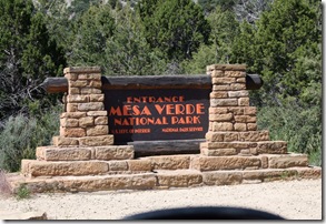
We drove less than a half mile today to Mesa Verde National Park.
We gladly handed over our National Park's pass at the ranger station. We are now up $85.00 on this little card. It really is one of the best things we've ever bought.
A little history on this park.
Spanish explorers seeking a route from Santa Fe to California in the 1760s and 1770s were the first Europeans to reach the Mesa Verde region, which they named after its high, tree-covered plateaus. However, they never got close enough to see the ancient stone villages, which would remain a secret for another century.
In 1873, John Moss, a prospector, visited the area and made his observations of the cliff dwellings and the surrounding area known. The following year he led photographer William Jackson through Mancos Canyon, at the base of Mesa Verde. There Jackson both photographed and publicized a typical stone cliff dwelling. In 1875 geologist William Holmes retraced Jackson's route. Reports by both Jackson and Holmes were included in the 1876 report of the Hayden Survey, one of the four federally financed efforts to explore the American West. These and other publications led to proposals to systematically study Southwestern archaeological sites, unfortunately they did not lead to action for some years.
Many of the cliff dwellings were looted of artifacts by the ranchers that had settled in the area. The artifacts were for personal home decoration and for the selling to tourists to the area.
Two decades of looting and destruction followed, the most responsible ranchers were members of the Wetherill family, who also had the best relations with the local Ute tribe on whose territory Mesa Verde was located. The Wetherills collected artifacts for sale to the Historical Society of Colorado as well as private collectors, and began assembling a small library of relevant publications. They also saw the tourist potential of the cliff dwellings they now systematically searched for. Over several years they turned the interest of their ranch toward guiding tourists through the cliff dwellings, and became the first experts on them. Although they continued to dig in the ruins, knocking down some walls and roofs and gathering artifacts without extensive documentation, the Wetherill's actions were more responsible and considered than those of the looters that preceded them. Modern archaeological opinion generally agrees that the Wetherill family were reasonable caretakers in an era before archaeological standards and federal oversight and protection.
One noteworthy early visitor was a New York newspaper reporter named Virginia McClurg, whose efforts over a period of years helped lead eventually to park status for Mesa Verde.
Through the years looting and destruction continued.
By the end of the 19th century, it was clear that Mesa Verde needed protection from greedy people. An early Mesa Verde National Park superintendent, Hans Randolph, described the situation at the best known cliff dwelling, Cliff Palace:
- ...Parties of "curio seekers" camped on the ruin for several winters, and it is reported that many hundred specimens therefrom have been carried down the mesa and sold to private individuals. Some of these objects are now in museums, but many are forever lost to science. In order to secure this valuable archaeological material, walls were broken down...often simply to let light into the darker rooms; floors were invariably opened and buried kivas mutilated. To facilitate this work and get rid of the dust, great openings were broken through the five walls which form the front of the ruin. Beams were used for firewood to so great an extent that not a single roof now remains. This work of destruction, added to that resulting from erosion due to rain, left Cliff Palace in a sad condition.
What a shame this happened. So much was lost.
On with our tour of Mesa Verde. Don't forget that you can click on the pictures to enlarge them.
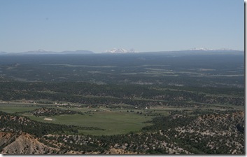
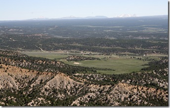
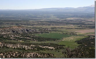
Our view as we drove up the mountain. Squint and you can see snow covered mountains in the distance.
Right in the middle of picture is where we are staying.
We are just glad everything is so G R E E N! No more brown of the desert for us!
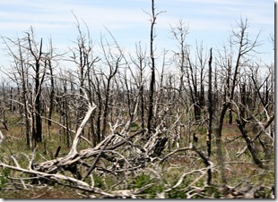
As we drove along for what seemed miles and miles we saw fields of dead trees.
Some we could tell were burned but other sections it just seemed like they were killed by blight or something. When we got to the Far View Visitor Center we asked a park volunteer what had happened to all the trees. She explained to us that since 1995 90% of the park had been on fire due to lightning strikes.
The Long Mesa Fire of 2002 was the worst. On July 29th, a previous day's lightning strike ignited the dry pinyon/juniper forest forcing the immediate evacuation of over 2000 visitors and employees from the park. Counted among the losses were three historic structures, two employee houses, a million gallon water tank, a sewer treatment building the phone and power lines. The park remained closed for the following ten days. The drought certainly didn't help matters.
In that fire 2601 acres - or 2518 football fields - burned. It cost $1.46 million dollars to douse that fire. Five helicopters helped the 376 firefighters and their 37 engines and pumpers put the flames out. The helicopters dropped 200,000 gallons of water. NO cliff dwellings were damaged.
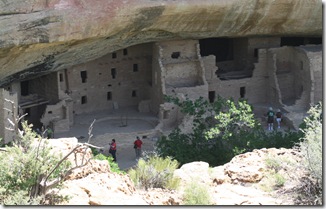
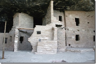
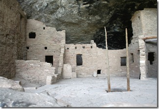
Our first stop to see the cliff dwellings was the Spruce Tree House. Our view before we walked down the half mile trail to see them up close and personal.
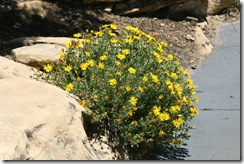
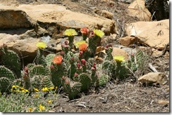
Flowers we passed on the trail.
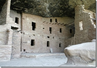
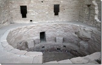
The Spruce Tree House cliff dwelling the third largest, of hundreds in the park, was built between 1200 and 1276 A.D. by the Anasazi. The dwelling contains a little over 100 rooms and eight kivas (pronounced kee-vahs), or ceremonial chambers. All this is built into a natural cave measuring 216 feet in width and 89 feet in depth. The guide said that about 100 people probably lived here.
It is so hard to believe that these structures are still here after all these years.
This is one of the kivas,,,,or ceremonial rooms.
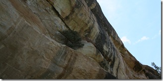
....and a tree grows....anywhere it wants.
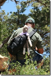
We followed this guy on the trail. Poor guy has a monkey on his back. Actually, its one of those sock puppets. His sister-in-law made it and they take it whenever they go on vacation and take its picture in really cool places.
After seeing all there was to see in this area we stopped for lunch. After we were done eating on a very nice outdoor terrace we stopped in the gift shop. We found that we were very lucky to have bought our piece of pottery at Canyon de Chelly. Pieces of the same size we have and of the same design ran 2.5 times what we paid Darlene Sam for ours.
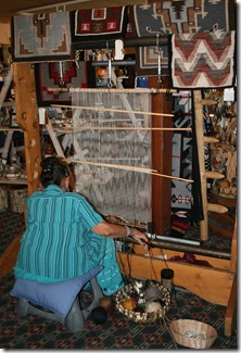
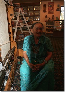
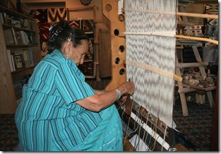
It was here that I met Doris. Doris is a Pueblo Indian and works at making rugs for sale in the gift shop. She volunteered that she is paid an hourly wage for making the rugs on site and then paid for the finished product. She wasn't too happy about this part though. Look at the rug in the upper right hand corner, top row. That rug, which measures approximately thirty inches wide by forty inches long retails for....are you ready for this? $2000.00! She said she makes just a fraction of what the rug retails for.
It takes her three to four months to make just one rug.
Doris told me about her family of four daughters that all work in the "trades" whether it be tinsmith, weaver, jewelry maker and what the forth one does escapes me right now but it was along the same lines.
She took the time to show me how the loom works and to answer any questions on something I didn't understand. This soft spoken lady was a true joy to talk with.
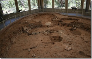
Our next stop was to see the foundation of a pit house. These houses were built in 600 A.D..
Back in the day there would have been four poles on which a thatch roof would have been placed, just about head high. No need in heating dead air space. These pit houses have now been enclosed in buildings with railings around them to protect them.
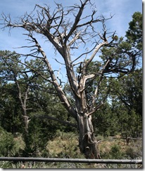
OK, LaVon, here's your dead tree for the day.
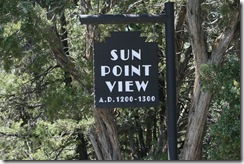
Next stop was Sun Point View.
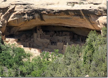
These pictures are taken from across the canyon. They only look closeup because of the 200mm lens I was using on the camera.
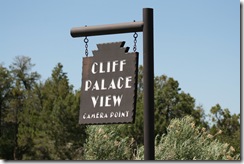
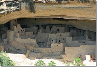
There is a high concentration of cliff dwellings Sun Temple - Cliff Palace area. Archeologists have found twelve ruins in this area. Apparently the Anasazi chose this area because of the proximity to water. There is a spring at the head of the canyon, about a quarter mile away.
It is believed that because of its prominent location that Sun Temple may have been the central gathering place for the surrounding communities of cliff dwellers.
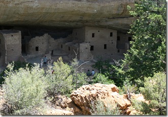
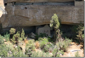
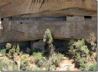
Further down the road we came across this cliff dwelling.
Take notice of the dwelling in the little alcove the upper right hand corner. Would you call this one a split level?
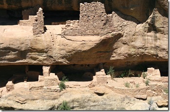
This next picture is of the Fire Temple. Though the alcove is filled with Puebloan construction there is no evidence that it was lived in. The central pit - too big for domestic cook fires - held layer upon layer of ashes. Fire Temple's size and carefully crafted, symmetrical features suggest community-wide ceremonial gatherings.
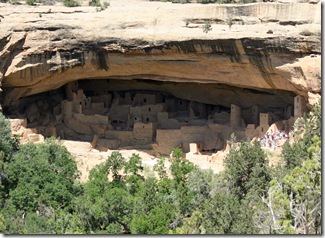
Next stop was....
These were taken from across the canyon.
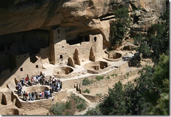
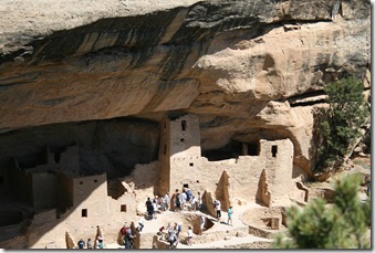
We drove even closer to get a better view. A ranger led tour was taking place.
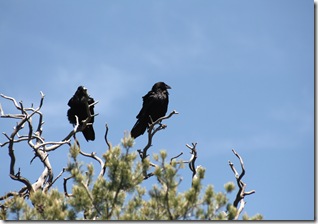
On the way back to the truck we spotted these two ravens.
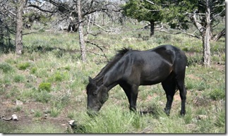
On the way out we saw this and three other horses. We were told by one of the rangers that they come from the Ute Indian reservation which borders the National Park. Every two or three years the Ute Indians come and round up the horses and take them back to the reservation.
So there it is. Mesa Verde National Park. Hope you enjoyed the tour.
1 comment:
Yes sireeee, you have developed quite the eye for dead trees! Thanks for posting this one!
Post a Comment